Recent visits to Thorpeness have revealed new erosion features, possibly exacerbated by extreme high waves observed in early July 2023. However, rather than focus on features on the cliffs and beach, this discussion will consider the nearshore processes likely to influence the shape of a beach.

A local feature known as the Sizewell-Dunwich Sandbank system (SDBs), will be used as a framework to analyse the complex shifting systems that shape and remake this coastline, as no feature remains stable for long. The SDBs are the most enduring feature, but historically they have changed position and size and continue to do so. This section of coastline is a dynamic, fluid environment, with its nearshore characteristics, still unclear beneath the waves. Therefore, this discussion will debate existing analysis of nearshore characteristics, alongside recent photos of erosion and high waves.

The first system to be considered concerns a model to assess the effects of sediment transport, tidal flows, and wave heights on the SDBs. Regarding sediment transport, Bedload, refers to how sediment is carried by water and bounces along the ocean floor. Suspended Load describes how sediment is picked up and retained within the flow of water. For both methods, it was found tidal flows cause a conjunction of sediment transport, on Sizewell Sandbank. With sediment flowing along the landward side of the sandbank in the tidal flood flow and deviating in a seaward direction to join sediment transported in the tidal ebb moving up from the south.
Along the coastline of Thorpeness, the tidal flood is thought to run in a southward direction, almost parallel to the coast. Tidal currents attain greatest velocity 5 hours before high water, at 0.67 m s-1 on spring tides and 0.31 m s-1 on neap tides. Tidal ebb flows run almost south to north attaining greatest velocities 1 hour after high water, 0.72 m s-1 on spring tides and 0.36 m s-1 on neap tides.
Given the propensity for sediment to travel northwards from Thorpeness, it is interesting to note higher velocities for the south to north ebb flow of the tide. This could be significant if a strong high tide, stirs up significant amounts of sediment on the beach. Particularly as sand from Thorpeness is thought to be transported to offshore sandbanks, whilst shingle is retained on the beach. This relates to beach profile, as larger wave heights can remove fine grain sediment lowering the beach level, whilst shingle is pushed in steep ridges to the upper beach.
This moves the discussion onto systems of wave action. A study ran model scenarios for different wave heights arriving from a North Easterly direction to assess the impact on the Sizewell Sandbank. In most examples, sediment accumulated on top of the Bank, whereas erosion occurred on the southward side. But in instances involving the biggest waves, the top of the Sandbank also became subject to erosion.
However, on this unstable shifting coast, it is useful to bear in mind that sediment transport can also be heavily influenced by wave direction. Whilst it is thought Thorpeness stands out as an unusual example of Northerly sediment transport on a coastline dominated by Longshore southerly transport. It is also the case that Southerly waves usually result in Northern sediment transport, and Northerly waves usually result in sediment transport in a Southward direction. Wave direction can also be cyclical, with Southerly waves dominating in one season and Northerly in another.
It has also been thought historically, that Thorpeness retains a layer of resistant Coraline Crag, which underlies the beach geology and stretches out from below North End Avenue towards the ‘Ness’. It is believed this has sustained the headland and the Sizewell Sandbank.
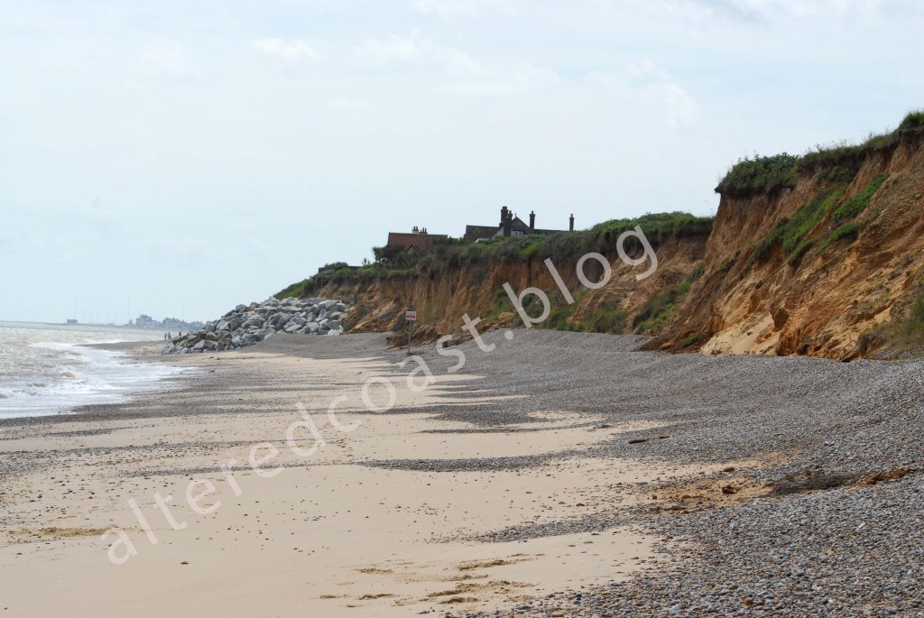
In relation to these points, a disturbed section of water that indicates the presence of Nearshore Sandbanks, can be seen near the location of the promontory of the Ness and Thorpeness Beach.

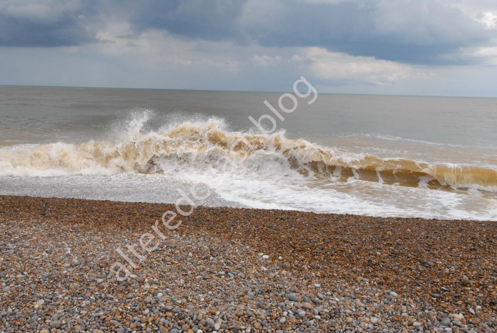
However, a photo taken a few days later in July, shows High Waves, probably caused by a combination of the Supermoon and Storm Poly, with the waves originating from a North Easterly direction. However, it is not possible to identify the line of disturbed water indicating the presence of the sandbanks.
But studies have found nearshore sandbanks at Thorpeness can attenuate (lessen) wave energy from NE waves. A study on Wave Refraction also outlines the importance of the sandbanks in reducing wave energy.
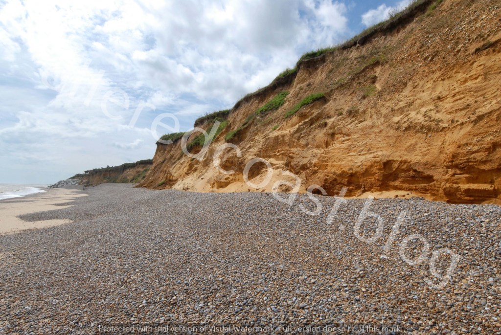
Whether the resistant layer of Coraline Crag is still holding firm, recent photos of erosion of the backshore seem to show exposed layers of darker rusty, red lumps of sediment pulled from the cliffs alongside Scarp erosion into the base.

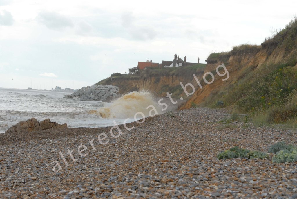
Additionally, recent erosion at Thorpeness, seen in the photo at the top of this discussion, shows erosion seeming at times to shift south to north along the cliff line. With waves arriving at different points on the beach compared to previously.
There are many contributory factors that can influence erosion features and patterns of wave energy arriving at a beach. A model to assess sediment transport, tides and waves, identified an area of increased Bed Stress in the nearshore at Thorpeness beach. With sections also apparent on the eastern and southern areas of the Sizewell Bank.
Bed Stress refers to abrasion applied by running water on the Seabed. Additionally, Bed shear-stress is created by a combination of waves and currents, that contain disorderly boundary layers that intermingle in a manner in which one element does not automatically follow another. With the water motion described as forceful for beds consisting of sand and gravel. It is also thought the ability of the subtidal platform in the nearshore at Thorpeness to reduce wave energy is lessened and sediment fluidity increases at this location.
Thorpeness sits on an extremely active coastline. With rapidly changing nearshore processes with its bathymetry (profile), interacting with tides and waves to shift and erode sediment. In a high-energy system which can be made more forceful by the powerful influence of weather systems. In a destructive forceful interplay, that leaves its mark, and can forever alter the shape of a beach.