

Pakefield Beach is a fascinating example of erosion and deposition of sediment. With a dramatic contrast between substantial accretion (build-up) of sand at Benacre Ness, with the assessment that this feature seems to be building up to the north, whilst eroding at its Southern end. The build-up of Benacre Ness could help protect Pakefield, but at the current rate of growth, the timescale for this protection, looks to be in around 7-8 years’ time.

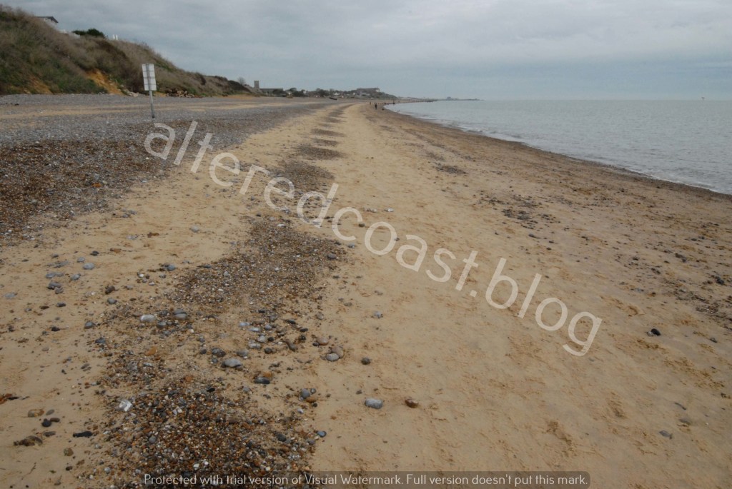
Whilst, despite local accumulations, very little sediment is retained on the beach between Pontins Holiday Park and where fishing boats are moored. The fishing boats are pulled up to a higher level of beach, as the foreshore is steeply sloping and appears stripped of sediment. A lowered profile such as this can make it easier for powerful waves to sweep up the beach, potentially making locations more vulnerable to storms. Like a powerful surge on Friday 24th November 2023, when a large section of Access Road collapsed at Pakefield.
However, erosion at Pakefield, can be caused by sea and rainfall, as both can cause alteration and failure. To look these points in a bit more detail, this discussion will consider the concept of the aggregated surplus strength of precipitation and wave action and consider what this means for the beach profile and the coastal community.
Looking at the aggregated surplus strength could mean analysing the cumulative effects of storms and rainfall to assess the force in each element and how this could contribute to the gradual weakening and break down of a cliff frontage.

Firstly, the effects of rainfall will be considered looking at an approach known as Seepage Erosion. This process refers to the flow of water once it enters a cliff face, possibly through a tension crack, the water flow can exert strength to initially form a watercourse with bonding of sediment sustaining the structure for a period of time. However, if water flow is subject to a level of agitation, this can concentrate erosion to gouge indentations, causing roofs of watercourses to eventually fail to form gorges or basins.
It is thought where channels are more intricately and extensively integrated into the cliff face, the greater the level of water required for Seepage Erosion. However, it is also thought network of watercourses can be complex and localised and structures so refined, it is hard to envisage their onward progression. This could make estimating possible forces at work and extents of potential failure hard to assess.
However, while these processes describe the physical mechanisms at work within the cliff face, at another point on the beach, gullies can be seen running down the front of the cliff face. It is also possible that such channels and gullies could widen over time, possibly eroding back into the cliff, causing failure, due to the application of stresses in the body of the cliff. Such processes could cause landslides or blocks of material to fall from the cliff.

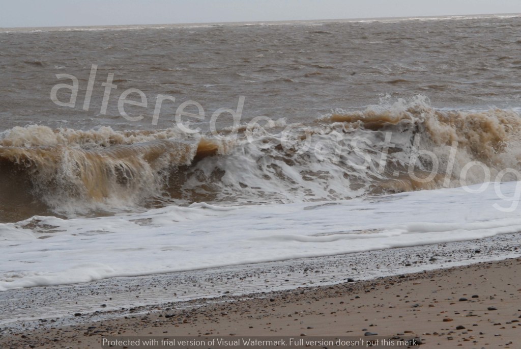
Another powerful element working away at the cliffs is of course wave action. On beaches with very little sediment coverage to dissipate energy, it is possible to see features that testify to likely forces at work.

One visible feature is sometimes referred to as a Megacusp Embayment. Factors that lead to their formation include varying sediment types, foreshore profiles and wave approach producing differing wave patterns. Such wave run-ups when interacting with the cliff face, alternately erode and deposit sediment, creating erosion “embayments” and “horns”.
It is thought several complex wave forms can create these features, but a basic summary could state that high waves with rapid occurring regularity, could act to mix sediment in the Swash zone as the wave flows up the beach and lower waves with slower regularity could possess reach to “collide” with the cliff face. Thereby loosening sediment and enabling mechanisms with a strengthening back wash to rapidly transport sediment off the beach.

Such processes can also cut into the cliff face, steepening and eroding the entire frontage. It is also thought such regimes can transfer sand to offshore bars, and there are considerably large sand bars in the vicinity of Pakefield beach.

In conclusion, the cliff face and beach at Pakefield continue to be vulnerable. Winds from a South Easterly or Northeast direction can keep sea water up on the beach. Equally beach levels are estimated to be around 2 metres lower. Pakefield Coastwatch, a coastal watch station manned by volunteer men and women, have recently begun to warn of high tide around 3 ½ hours before it is due, presumably because the tides come in quicker due to lower beach levels. Further falls of old beach road continue with old caravan bases, extending over a metre out from the cliff tops. It is thought erosion is shifting South to North, with erosion of base of beach steps evident.
Walking on the access road on the cliff top, empty plots act as empty reminders to those with properties and lives still to be lived on the landward side of the road. Testament to the unpredictable aggregated surplus strength of forces this eroding and stripping away this fragile coastline.
