
Following recent high waves and strong winds on the East Anglian coast, it is perhaps appropriate to announce the 5-year anniversary of the blog Altered Coast and its previous incarnation Altered Marshes.

The original inclusion of the word marshes is due to a visit in 2020 to Hazlewood marshes, an intertidal reserve next to the Alde and Ore estuary, run by Suffolk Wildlife Trust. The experience of visiting Hazlewood and the reason for its present incarnation, prompted an interest to find out more and Altered Marshes was set up as means for these discussions.
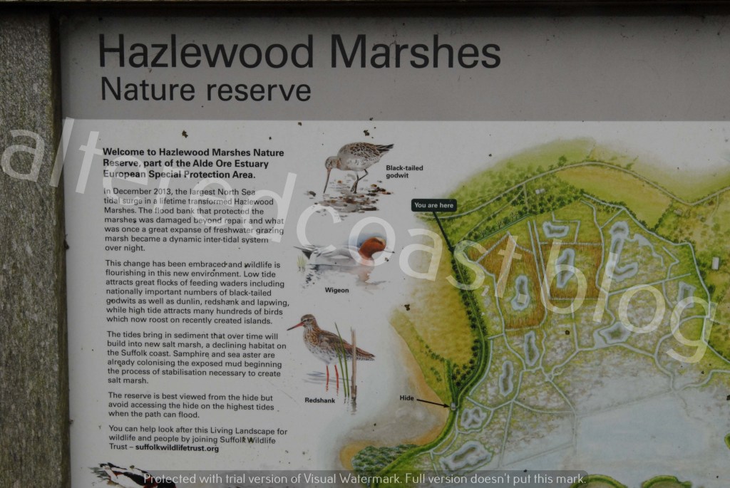
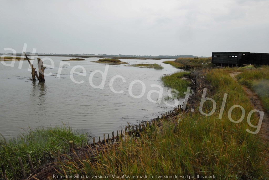
Hazlewood Marshes used to be a Fresh Water marsh, but became intertidal following a storm surge in 2013, which broke through the sea wall between the estuary and the marsh. The reserve is thriving now, but erosion continues, with work constantly needed to protect the path out to the Bird Hide, on the right-hand side of the reserve.
Altered Marshes started, therefore, to look at estuary systems and erosion around the Alde and Ore Estuary in Suffolk. However, the 1st Anniversary post in 2021, concluded by outlining a change in focus to look at the characteristics of tides in the estuary and the open sea. To consider how these elements can shape the areas under observation. Therefore, the progression to the open coast had begun and subsequently, the name changed to Altered Coast.

The first location observed on the open coast was Thorpeness, one of many dynamic vulnerable locations to be visited, which has subsequently included Pakefield, Covehithe and Hemsby.

Study of the exposed, fast eroding beach at Hemsby brought a focus on the influence of near-shore processes, and the morphology, (shape) such as sandbanks. As well as a study of the effects of high-energy waves on beach levels, and dune frontages. This is turn, introduced ideas around coastal geomorphology. An academic discipline that considers the profiles of coastal geographies and the systems that influence their form. In addition, the influence of near-shore features on waves and how wind and waves are both influenced by coastal profiles and can also shape and irrevocably change and re-work coastlines.
The intention of discussions going forward is to try and take a step back and as well as examining locations individually, to also look at erosion, sea states, morphology (shape) of coastlines, rainfall and flood defence in a bit more depth. In addition, as Altered Coast continues to observe and analyse coastal change, storms and sea states, the concept of Palimpsest will be considered again. To see features of coastal damage as signposts, information boards, to tell of what has happened, and to enable a learning about what has happened before.

To also set discussions in an historical context, by looking at communities previously lost to the sea, such as Dunwich, to try and understand coastal erosion anew. To keep an awareness of the proximity of the East Anglian coast to Doggerland. An area of land between Europe and England, inundated at the end of the last ice age. Forcing communities that dwelled on the land to flee the rising seas. In a poem by Justina Hart called Doggerland Rising, Hart wishes to ask what our Mesolithic ancestors might whisper to us through the centuries if they could, about how we should interpret loss, re-working of coastlines and changing seas.
