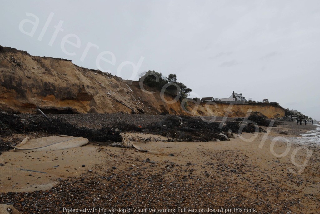
Severe erosion sadly continues to see demolition of properties on North End Avenue at Thorpeness. It is thought over 6-8 metres of cliff has been lost in recent months.
This cliff retreat is in addition to loss measured by coastal managers, for the location south of the rock revetment at Thorpeness Beach, the site of the most recent demolitions. For monitoring purposes, the area is categorised as Transect SO38, and retreat of around 20 metres is assessed to have occurred since the first survey in 1991.
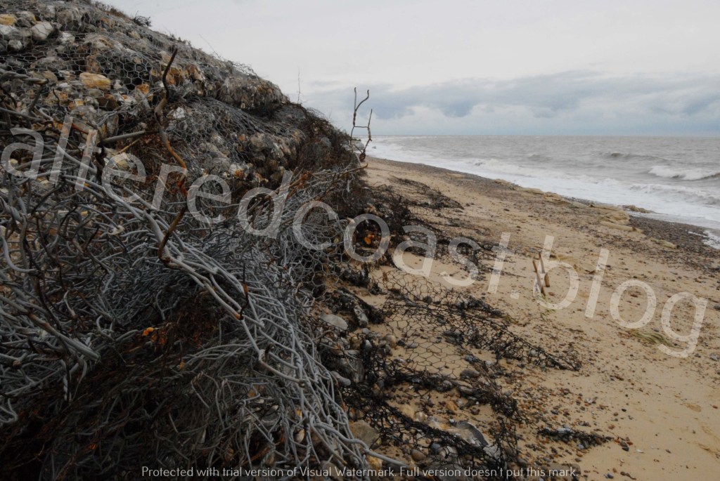
As a physical contribution to attempts to understand the erosion, a photo taken in late December 2024, could hint at early processes at work immediately south of the rock revetment on Thorpeness beach. It appears wave action was reaching beyond the Gabion stone baskets and starting to erode into the face of the sandy cliffs.

This location, and Thorpeness Beach more generally, can be a very high-energy environment. Conditions made all the more dynamic by the increasingly intense storms that hit the UK. Severe erosion at Transect SO38 is thought to have occurred between December 2024 and April 2025. But winter storms to date in 2025 could have worsened the erosion.

Storm Claudia hit the UK on Friday the 14th of November 2025. The Shipping Forecast predicted Gale Force 8 wind gusts and the wave buoy at Lowestoft recorded a Significant Wave Height of 3.5 metres. The storm alert threshold is 3.06, waves at or above this height are thought to have the potential to move significant amounts of beach material. On 16th November 2025, a Flood alert was issued for the Suffolk coast from Lowestoft to Bawdsey. A very powerful storm surge of around 1 metre was forecast to raise the tide at Lowestoft to almost 3.5 metres.
On 1st December 2025, severe gale force 9 and Storm Force 10 wind gusts were forecast for Aldeburgh, with a wind direction of SSW. A SWH of just over 3 metres was recorded at Lowestoft. On 5th December 2025 the Met Office forecast strong winds speeds of Gale Force 8 – Severe Gale Force 9 and Storm Force 10 winds for Aldeburgh from a SSW/S/SSE direction. On 6th December a SWH of 3 metres was recorded at Lowestoft.
Thinking about the area below the location of the recent demolitions, south of the rock revetment. It is possible to wonder at the energy levels in the wave action that contributed to the severe erosion. Particularly as it is thought on mixed sand and shingle beaches, the surf zone (where waves break) can be quite narrow. So waves can also break directly in the swash zone, the area of beach where waves rise and fall. Meaning almost all energy is expended when waves break and wash up the beach.
Wave action can be influenced by and fundamentally re-work the structure of the beach. Each crashing of a wave as it rushes up and flows down, echoing earlier actions, constantly repeating and reinforcing new patterns. With forceful actions driving instability deep into the cliff structure. Additionally, the seepage flow of ground water combined with the destructive backwash of a wave can flow out through the shingle, drawing sediment out to sea.
The configuration of a beach can withstand sustained storm damage and can indicate stability for days, weeks or months. But maybe the recent increased force and intensity of storms capable of deepening rapidly, could exert such a strength they could force a break in the bones of the beach. So that ability to recover and repair no longer apply and it could be asked whether it is the design of the beach that still determines wave action. Or whether now it is the waves themselves which master the beach, sediment and cliffs they encounter.