Alteredmarshes – Anniversary

It is just over a year since this blog first began exploring coastal erosion on the Suffolk coast, with a specific focus on the area around the Alde Ore estuary.

Regular observations have been made of indicators of the impact of the sea, on shorelines, embankment flood defences, and nature reserves such as Hazelwood, the original inspiration for this blog. The reserve is both an example of what can happen when flood defences breach, but also how an intertidal reserve can develop and evolve.  

Particular areas have been chosen as they either represent frontline meeting points with wave energy and sea levels, or they provide examples of the erosive properties of salt water on estuary defences or reserve paths and perimeters. Each area is different with its own characteristics, and each can offer unique contributions to a study of coastal erosion.

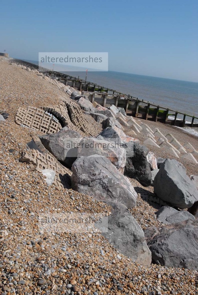
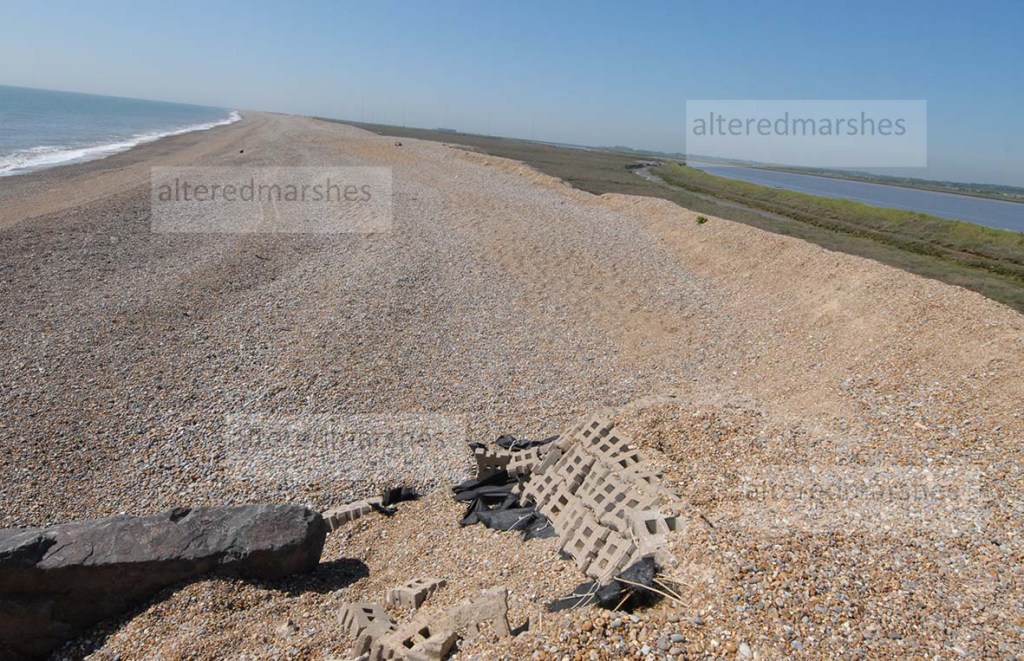
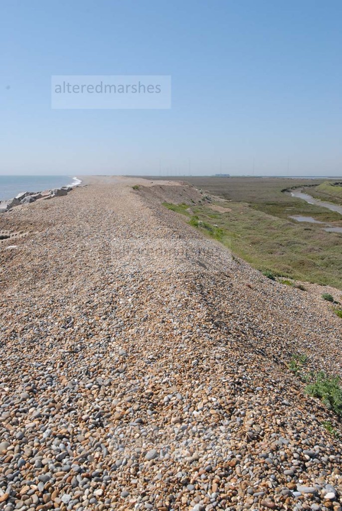
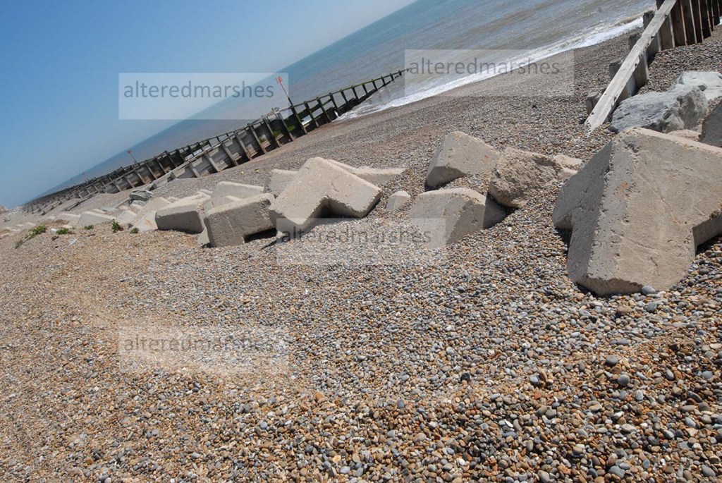
On the open coast, Aldeburgh and Sudbourne Beach, serve as dynamic examples of the power of the sea to shift shingle and overtop urban sea defences, as they inhabit the shifting thin line between the sea and the Alde Ore Estuary.

Shingle on Sudbourne Beach and Saltmarsh on the edge of Alde Ore Estuary

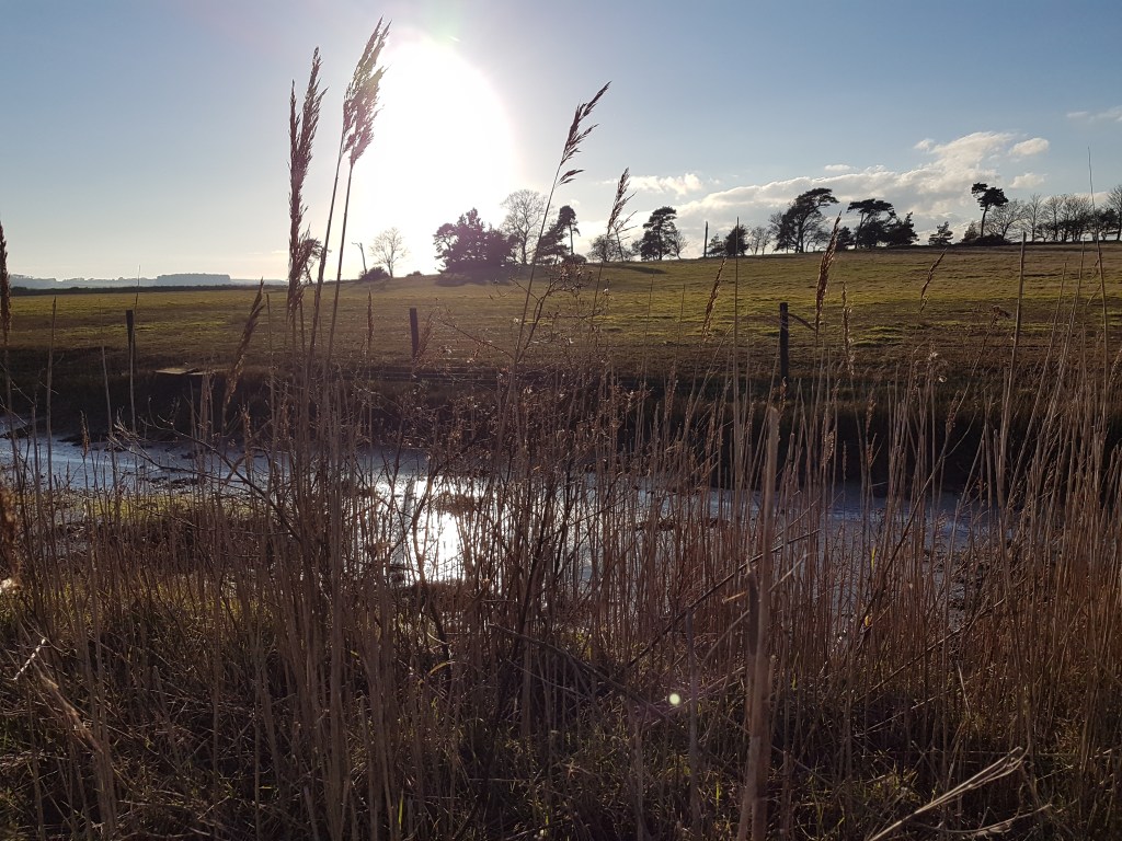
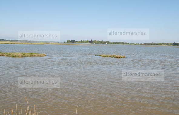
Away from the boisterous activities of the North Sea, but impacted by it on a daily basis, Iken cliff is a peaceful wide expanse of the Alde Ore estuary. It seems a far cry from the turmoil of storm tides that have breached the old flood defences and threatened Iken cliff defences, but the area is of interest, because of the relatively high tides, in the upper reaches of the Alde Ore estuary, some distance from its mouth.

High tide, Iken Cliff, Alde Ore estuary

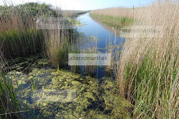
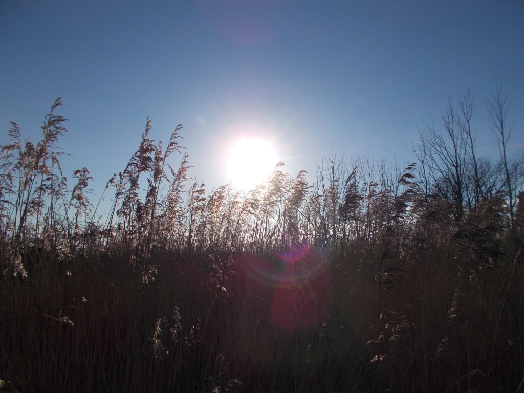
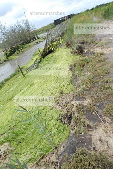
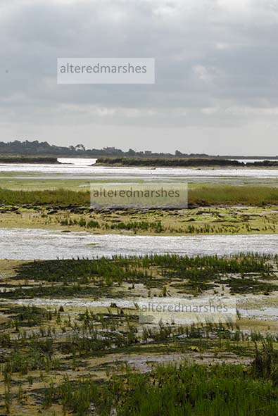
Another peaceful area, observed on a regular basis is the freshwater nature reserve, on Iken marshes, below the Alde Ore mud flats. Bearded Tits inhabit the Reed beds and Lapwings, nest on the marshes in the summertime. Embankment clay flood defences separate the estuary from the reserve and provide a useful example of how established saltmarsh can mitigate wave action. It is also possible to see, where the embankment is not fronted by saltmarsh, the high tide level marks, and how erosion of the concrete revetment could wear away at the base of the flood defence.

Flood defence with exposed concrete revetment alongside flood defence fronted by Saltmarsh

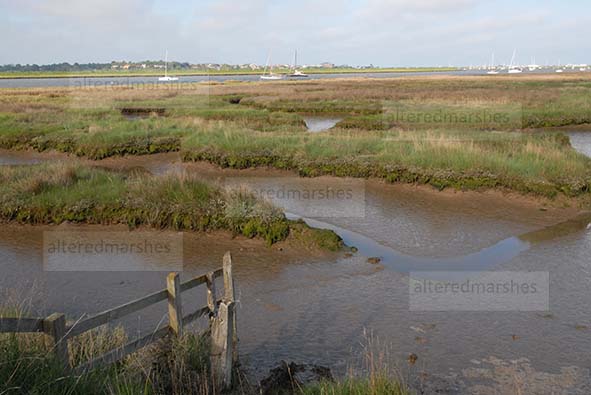
Finally, Hazelwood marshes provide a constant inspiration, a thriving intertidal nature reserve, whose growing biodiversity and sediment accretion, develop in the former freshwater channels and on the raised nesting islands built for nesting avocets and shell ducks and spoonbills. Erosion can be seen on the path near the bird hide.

Scouring of path, leading to bird hide, Hazelwood Marshes

However, new growth of saltmarsh can be seen on the main marsh, which could contain wave energy on the marshes.

New vegetation, growing on Hazelwood Marshes

The features of each area continue to provide interest and are worthy of continued observation, but one factor that has been present, that has not yet been discussed, is the tidal prism and the velocity of the tides. Additionally, wave heights in the open sea, and how these could impact the coast and the estuary, are also relevant to observations of coastal erosion on the Suffolk coast. The term Tidal Prism refers to the volume of water that enters and leaves an estuary with the rise and fall of a tide. The velocity of the tides describes the currents and the energy of the tides as they ebb and flow. Wave heights out at sea, at specific points where they are monitored, can also give an indication of how under storm conditions, wave activity could move shingle, altering beach structures, and contribute to erosion. Therefore, the focus of the blog in the near future, will be to examine the characteristics of the tides, in the estuary and the open sea, and discuss how these elements shape the areas under observation.

Waves on beach at Orford Ness

Alde Mud Flats

On the right-hand corner of Iken marshes, there is a freshwater marsh nature reserve, near Stanny House Farm, just below the Alde Mud Flats, on the Alde Ore Estuary.

Sign describing Alde Mudflats Nature Reserve

The reserve is home to Marsh Harriers and Lapwings, as well as Bearded Tits, which nest in the Reedbeds.

Reed beds in a freshwater channel on Iken Marshes

It is on the right-hand side of what is known as Flood Cell 5. Areas at risk of flooding, on the estuary are divided into cells to assess their vulnerabilities. The reserve offers an example of the use of saltmarsh in front of flood defences. Several studies have assessed the usefulness of this form of flood defence, particularly in relation to sea level rise (SLR). It has been found that saltmarsh can dissipate wave energy, but it is debatable whether this would continue under a SLR scenario. Latest predictions for seal level rise, forecast that Global Mean Sea level could rise to at least 0.29-0.59 m for a low emissions scenario and 0.61-1.10 for a high emission scenario.

Flood embankment separating freshwater nature reserve and saltmarsh on Alde Ore Estuary

It is undoubtedly the case that, where saltmarsh is absent in front of a flood defence, there can be found examples of erosion at the base of flood defences and into the concrete revetment installed as a means of flood defence.

Evidence of tide height and tidal water impact on concrete revetment at base of flood defence

Where tidal water reaches right to the bottom of flood defences, the tide can rise quite high, with the full energy of the waves, potentially weakening structures and embankments.

Erosion at base of flood defence not fronted by saltmarsh

To encourage vegetation as an initial method to develop saltmarsh, groynes are inserted, to enable vegetation grow, in between the groynes and the base of the flood defence.

Groynes placed to encourage vegetation, Alde Ore Estuary

Two studies into the performance of saltmarsh under SLR, have reached different conclusions. A study by Moller et al, found that Saltmarsh offers substantial wave attenuation, even when tide levels are elevated and waves heights increased. When waves compress and rupture vegetation stems, diminishing the loss of wave energy, the actual base of the marsh remains firm and resilient to erosion (Moller et al, 2014).

However, a study by Best et al, concludes that ultimately, saltmarsh vegetation, that form flood defence systems, will be unable to withstand SLR. As wave transportation of sediment to the saltmarsh, increases its height, wave momentum, becomes focused on the Mean Sea level, which can increase erosion. Channels accelerate movement of sediment within the saltmarsh, with increased wave heights decreasing the width and increasing the height of the saltmarsh. Eventually, channel networks reach further towards the land and carve into the saltmarsh. If the saltmarsh is unable to adapt to SLR, vegetation will be pushed towards the land, to accessible areas of higher ground. SLR can increase water levels, enabling waves to travel further into the saltmarsh. A bigger tidal prism, results in greater wave energy, contributing to increased sea facing erosion and further landside sediment deposition (Best et al, 2018).

It is unclear whether this process can be said to be occurring within the saltmarsh at the nature reserve on Iken marshes, near Stanny Farm. A study by Kearney and Fagherazzi, 2016, has found that channels in saltmarsh can encourage the swapping of water, nutrients and sediment amongst saltmarsh and estuary, which can boost vegetation.

Channels in Saltmarsh, Alde Ore estuary

The Iken marshes nature reserve, below the Alde mudflats, provides a good case study of managing saltmarsh and clay embankment flood defences whilst sustaining freshwater reserves. While the nature reserve is a tranquil space, the dynamic of SLR means the nature must co-exist and may ultimately be shaped by the high-velocity tidal systems, already eroding its edges.

Hazlewood – intertidal fortunes

Hazlewood marshes provides unique biodiversity in an environment moulded by its fortunes as an intertidal reserve.

Sediment deposits are accreting at Hazelwood, noticeably in the former freshwater channels. The sediment is thought to consist of estuarine silt, which could concur with analysis that describes the Alde Ore estuary as flood-dominant, i.e that it has a tendency to drop silt.

Vegetation in water channels, Hazlewood Marshes

As part of a report in 2014 by Kenneth Pye Associates, to investigate the implications of allowing Hazlewood to become intertidal, analysis was conducted into the sediment content of the Alde Ore estuary. It was found that sediment in the upper reaches of the Alde Ore estuary, consisted mainly of mud, but sand and gravel could be found in creek beds and in the toe of eroding marsh cliffs. Research has also found that erosion of the north Suffolk cliffs could supply 95% of the mud 89% of the sand and 62% of the gravel sediment found on the open coast and in the estuaries of Suffolk (Burningham, French, 2016).

It could be said, one fly in the ointment at Hazelwood, is that alongside the vegetation, bird, fish and sea life, the activities of the daily tides and the connection to the North Sea continue to shape the landscape.

Flies in spiders web looking out of bird hide on Hazlewood Marshes

The bird hide at the far end of the marshes which affords excellent views across Hazlewood and provides views to Ham Creek in the estuary, gets cut off by high spring tides.

Bird Hide, Hazlewood Marshes

The path to the hide is also being eroded across its width, possibly as a result of dessicated cracking.

Evidence of erosion on the side of path facing the estuary tides, on way to bird hide, Hazlewood Marshes
Erosion on estuary channel facing side of path, Hazlewood Marshes

The same process that contributed to the visible signs along the length of the remaining sea wall at Hazlewood, where evidence of failure of the entire landward facing wall can still be seen.

Evidence of back wall failure on remaining sea wall at Hazlewood Marshes

Sediment accretion and the development of islands, with saltmarsh are known to reduce the destructive energy of tidal waves. However, a report has found that rising sea levels could potentially reverse reductions in wave energy from offshore sand and shingle banks and saltmarsh (Burningham, French, 2016).

In its current form, Hazlewood continues to thrive, and potential exists for discovery of key fish species which are a conservation target for the Alde Ore estuary. But as the saying goes, time and tide wait for no man or living organism, in a dynamic, ever-changing intertidal regime.

Sudbourne Beach – Evolution of a shingle ridge.

In a continuation of discussions about Sudbourne beach, south of the Martello Tower in Aldeburgh, Suffolk, consideration will be given to the current position of Sudbourne beach.

Thanks to access granted by the Environment Agency, it has been possible to get a recent visual image of the dynamic interplay between the sea, the shingle ridge and the Alde and Ore Estuary.

Along this stretch of coast, there are three types of flood defence, which form structures within and on top of the shingle ridge, which stretches from the Martello Tower down to Orford Ness. The flood defences rather than form an impenetrable barrier, either flex in response to the action of the waves, or attempt to mould the shingle around boulders and concrete pillars, while the sea scours indents into the shingle ridge at the top of the flood defences.

Boulder, Concrete Pillar and Concrete Mattress or Interlocking Revetment Flood defences, Martello Tower, Aldeburgh

The Environment Agency recycled the shingle ridge on Sudbourne beach in 2018, but this work was undone by winter storms in a matter of weeks. The purpose of this recycling and the use of flood defences seen on the edge of Sudbourne beach, and the use of Saltings between the shingle ridge and the estuary is to dissipate the energy of the waves when they hit the beach. Even though these defences, on their own will not ultimately stop a breach, as can be seen by the failure in the interlocking block revetment, which is beginning to outflank the end of the flood defence. They do attempt to hold together the natural structures of the beach. The situation at Aldeburgh offers a useful case study into types of flood defence, as either side of the boulder etc defences, the sea is pushing shingle ridges higher up towards either the estuary or the built-up areas of Aldeburgh.

Shingle ‘cliff’ ridge at the top of Sudbourne Beach, with interlocking revetment in the foreground

As it is the sea that is dominant here. The ridges on the beach show the reach of the tides, the ridge nearest the shore is the low tide and the ‘cliff’ ridge at the top of Sudbourne beach signifying the reach of a high storm tide. This ridge has been gradually getting narrower with shingle being eroded from the sea-facing, front of the ridge. It is also noticeable that the shingle ridge at the top of Sudbourne beach, swerves back away from the sea, towards the estuary. The height of the ridge is maintained, but the top of the ridge becomes narrower and seems to reduce the distance between shingle ridge and the edge of the estuary.

Swerve of the Shingle Ridge at the top of Sudbourne Beach, back slightly towards the estuary

There are visual signs that the sea has overtopped the section of shingle ridge south of the Martello Tower.

Signs of overtopping of waves from the sea south of the Martello tower at Aldeburgh

It is both the day to day, dynamic interplay between wave action and winds as well as occasional storm events that contribute to the instability of this stretch of coastline.

Scouring into the shingle, at the top of Concrete pillar flood defences, south of the Martello Tower, Aldeburgh

Iken Cliff

Iken Cliff, near the Snape Maltings, in the Alde Ore estuary, is an area backed by sandy cliffs, fronted by reed beds and salting’s and boat moorings. One noticeable feature is the presence of breached flood defences. One cause of breaches in flood defences is a process known as desiccated cracking, which involves flood water seeping in through existing cracks, causing weakness and breaches in the landward side of flood defences. Cracking can occur right across the width of the flood defence.

Photo taken at low tide, on the 8th April 2021, on top of an old flood defence.  

Eddies in the water, show levels to be quite high against the tops of old, breached flood defences, as the high tide retreats. The peak of the high tide on 9th April 2021, was at 12:47, and this photo was taken about 50 minutes later.

Breached flood defence shortly after high tide on the 9th April 2021

Figures gathered from tidetimes.org.uk show approximate daily tide times and levels. On the 9th of April 2021, the high tide was 2.76 metres, which was the highest for the 9th of the month for 2021. But in comparison to figures from the 9th of the month going back to 2019, the tide on the 9th April 2021, was the lowest. In 2019 the high tide at 16:39 was 2.77 metres, and in 2020 the tide at 15:02 was 3.08 metres. Interestingly, the low tide on 9th April 2021, was highest measurements for a low tide for 2019 and 2020. In 2019, the low tide at 23.02 was 0.75 metres. On 9th April 2020, the low tide at 21.32 was 0.62 metres. However, the low tide on 9th April 2021 at 19.18 was 0.98 metres.

Figures that give rough idea of tide times on 9th April in from 2019 – 2021. Sourse of data: tidetimes.org.uk

Water partially covering the path by the side of the estuary indicates a high tide can reach right to the edge of the estuary space. Sections of path fronted by reed beds and salting’s, showed much less surface water, which suggests vegetation can act to limit the reach of tidal waters.

Path partially covered by tide water. 9th April 2021

The composition of Iken Cliffs is very sandy, though there is overgrowth and large tree roots which can add structure. But the ever-present erosion risk is indicated by warning signs to passers-by.

Sign on Iken Cliff warning of cliff erosion. 9th April 2021

There are long-standing flood defences at the bottom of one part of Iken Cliffs and it looks possible that these defences and the trees in the flood defence and the grass may resist any rising tide. Though the top of the flood defence and bottom of the embankment could be vulnerable to scouring by flood waters as well as desiccated cracking, as a rising tide does not necessarily have to overtop to weaken a flood defence to cause it to breach.

Tyres and small boulders at base of earthen flood defences. 8th April 2021

One of the special features of the Alde Ore estuary are the seals, and this photo shows a seal in the foreground resting on an island, with another seal swimming behind. It is a nice peaceful estuary image to conclude on, aside from the turbulence of tidal erosion, past and present.

Seals at Iken Cliff in Alde Ore Estuary. 9th April 2021

Landscapes of marshes and estuary

A selection of photos taken in February 2021 show the current landscape of Aldeburgh Marshes and Hazlewood marshes as well as the history of the scouring effects of the tidal surge in December 2013.

The first photo shows the lasting affects of the scouring of the trees at the back of Hazlewood marshes, alongside the raised islands created more recently by Suffolk Wildlife trust to attract Avocet’s and other birds.

The second photo shows reed beds which have survived at the back of Hazlewood marshes. The Reed beds would have been important habitats for Bitterns when the marshes were freshwater habitats before the tidal surge.

The third photo is taken from the top of the estuary flood defences, looking out to Aldeburgh marshes on the right and the Alde Ore Estuary on the left. The flood defences are built to reduce the effects of tidal surges risking damage to Aldeburgh marshes and town.

The fourth photo looks out on the Estuary at the shore of Iken Cliff, near Snape. Flood defences at Iken marshes, near Iken cliff were subject to partial and actual breaches due to the tidal surge in December 2013. The breaches to the freshwater reserve were repaired quickly, but the area continues to be vulnerable to future breaches due to tidal surges. Flood defences out in the estuary show signs of previous breaches.

Finally, the peace of the winter sun on Hazlewood marshes, shows a reserve that continues to thrive and is home to many native and migratory birds.  But the area, like the rest of the estuary is subject to the forces of the North Sea and the ability of aging flood defences to withstand rising sea levels and consequent storm surges.

Sudbourne Beach – an update

This piece seeks to provide a brief update to a previous piece on Sudbourne Beach, which is a shingle spit south of Aldeburgh on the Suffolk coast.

A public consultation was held between 1 October – 30 November 2019 regarding the policy of the Coastal Partnerships East and East Suffolk Council Shoreline Management Plan (SMP) in regards to Sudbourne beach. The consultation sought views on whether the policy of the SMP should maintain an interim position of No Active Intervention, after the current policy to Hold the Line expires in 2025. The alternative up for consultation, was a change of policy to Managed Retreat, which would seek to actively manage the rapidly eroding shoreline at Sudbourne Beach.

As the result of the public consultation the East Coast Council has now formally adopted a permanent policy of Managed Retreat, which will mean Managed Resilience of the Shingle shore, extended to 2100.

Recent reports from the Environment Agency state that as a result of winter storms, the ridge on Sudbourne Beach is changing daily. A reminder that the future of this fragile spit is bound up in the actions of the shifting ferocious tides and the authorities and concerned residents attempting to prevent the spit submitting to the erosive forces that threaten its future.

Embankment Wall Breach

In field studies on the Essex and Kent coasts following the North Sea 1953 storm surge, academics, Cooling and Marsland listed four possible causes for flood embankment failure. Three of these causes are particularly useful to consider regarding the failure of river walls at Hazelwood marshes and Havergate Island. These are, a) erosion of sea-facing embankment wall by wave activity, b) erosion of land-facing embankment due to over-topping, c) slippage or slump of land-facing wall due to water dripping through the bank.

The three causes of failure described above can be said to be examples of two distinct processes, Scouring and Desiccating Cracking. Of the causes listed above, a and b, can be associated with scouring and c can be attributed to desiccated cracking. The elements of each process and how they contribute to flood embankment failure will be considered in more detail.

The process of scouring can occur when water overtops a flood defence and reaches the ground on the landward side of an embankment in a state of turbulence, therefore, it could be said, erosion begins the moment the wave reaches the border between soil and water. The force that moves the wave interacts at speed with soil at the base of the landward side of a flood embankment. At this point, two processes are said to be at work, the immediate movement of the water directed by the physical space it hits and the state of the soil when the wave meets the ground.

The immediate area the wave hits is said to contribute to scour due to water meeting an obstruction, presumably this could be a rock or the edge of the base of the river embankment. Meeting this obstruction can interrupt flow and decrease its space and redirect surge water. As this alteration is very sudden and occurs at speed it can multiply the rapidity of the energy directing the water which can cause eddies to form.

The state of the soil the wave meets when it hits the ground, contributes to what is known as shear stress. Britannica.com define shear stress as an energy whose impact can distort a substance causing sliding along a horizontal surface alongside the source of the stress. The shear that occurs correlates to the descending progress of earth impacted by this process. The extent that shear stress causes a deep scour hole is related to the make-up of the soil at the base of the embankment, depending on soil makeup, sheer stress can lead to an eventual lifting of sediments particles causing scour.

A photo that was taken after the storm surge of December 2013 showing evidence of a shallow slippage, caused by scouring after wave overtopping.  

Photo from: https://www.google.com/search?q=AOEP-Estuary-web.4.compressed&rlz=1C1CHBF_en-GBGB894GB894&oq=AOEP-Estuary-web.4.compressed&aqs=chrome..69i57.1077j0j7&sourceid=chrome&ie=UTF-8

The second process that can cause an embankment to breach is Desiccated Cracking. This is particularly said to occur in alluvial clay, a material used in some flood defences in the Alde Ore estuary.

Desiccated Cracking or fissuring relates to the formation of an intersected web of internal vertical and horizontal fissures, about 60 cm deep within the surface layers of a flood embankment. It is thought repeated wetting and drying of estuary embankments can contribute to desiccated fissuring.

In a flood surge, large amounts of water drip through desiccated fissures, in extreme conditions, this can cause hydraulic fracture, when the flow transmits through fissures to the landward side of a river wall. Rather than a wave overtopping, water flows through fissures below the crest, into the embankment. This can cause the lifting of blocks of material, leading to gradual slope failure and the eventual breach of a river embankment.

Photo from: https://eprints.hrwallingford.com/1291/

Regarding, the process of water seepage that causes failure on the land-facing embankment, a member of the Alde Or Association visited Hazelwood marshes during the storm surge at its peak on December 6th 2013. It was reported that the water level reached the top of the embankment with minor overtopping at low points. However, the observation of real interest was amount of free water flowing through desiccation cracking issuing from the landward bank. This is indeed the puzzling aspect that strikes an outside observer of photos of the after-effects of the storm surge at Hazelwood, that they all seem to show water flowing outwards from the land-facing side of the embankment.

Photo from https://eprints.hrwallingford.com/1291/

The two processes of Scouring and Desiccated Cracking are separate yet are linked in that they interact and are influenced by the physical space and soil make-up of the flood embankment they detrimentally affect. Scouring interprets then shapes the space and the particles it interacts with, the scouring out of the base of a flood embankment, being the physical result of this interpretation. Whilst desiccated cracking, develops over time within the structure of the embankment, with the fissures functioning as vehicles for the rapid movement of water and its mechanisms of erosion.  

The tendency of recent storms to become ever more powerful and unpredictable alongside rising sea levels, make the complex processes of scouring and desiccated cracking increasingly useful to understand, so the effects of storm surges can be assessed to reduce the likelihood of flood embankment failures.

Havergate Island

Havergate Island is situated near the Suffolk village of Orford, at the meeting of the Ore and the Butley rivers.  The Ore divides in two around the two-mile long Havergate Island with flows splitting through what is known as the Gull on the north side of island and the Narrows on the south of island. Coriolis forces, roughly defined, state a force influenced by the earth’s rotation tends to deflect moving elements to the right in northern hemisphere and to the left in southern hemisphere. Such forces would suggest flood tidal flow would run through the Narrows and ebb flow through the Gull. Both flows are similar in width, but the Gull is much deeper.

A video, kindly provided by the RSPB taken by a warden at Havergate in 2019, shows a breach caused by a sea surge. The breach was at the narrowest part of the island, on the side facing the Gull, on Havergate Island.

A large sea surge in December 2013 breached the sea walls at Havergate. In order to limit damage from any future surges, the RSPB, introduced a scheme to allow certain areas (known as ‘sills) to overtop. The purpose is to allow the sills to flood in a relatively controlled manner to manage water inundation and enable areas recover relatively quickly.

This approach seeks to address the problem of storm surge sea water once it enters a reserve scouring (eroding) the insides of sea walls fundamentally weakening them. When this occurred during the December 2013 storm surge, the RSPB at Havergate built up damaged walls, but are aware the walls may never be as strong as they were.

Internal scouring of sea walls was one of the main causes of damage following the 2013 surge. As the reserve contains saline lagoons the flooding of salt water wasn’t as damaging as it was to the freshwater marshland at Hazelwood marshes. Wildlife has also recovered following the 2013 surge with the hare population recovering and uncommon yellow vetch growing again.

As the RSPB have lowered sections of the sea wall, they are able to utilise sluice gates to allow flood water to leave lagoons without surges causing lasting damage. The process for creating the lower sea walls in addition to reducing wall height involves laying wire netting on the lowered sea wall and sowing grass seed. Once the grass has grown, combined with the wall lowering and the net laying, it should enable defences to withstand several hours of overtopping. Such schemes are favoured as they enable constructive management of overtopping. Which often proves cheaper than dealing with breaches in sea walls which are seen as more damaging and costly to fix.

Regarding the future of Havergate Island, it has been predicted by site manager Aaron Howe that the reserve could have another 20-40 years before it succumbs to coastal erosion. Increasing storm surges and rising sea levels are developing alongside another process, known as Isostatic Rebalancing. This refers to the post-glacial rebound of northern Great Britain which is said to be happening at a rate of around 10cm per century. This is causing a corresponding downward movement of the southern half of Great Britain, which is developing at around 5cm per century. This could increase the risk of floods in southern England.

The sea is nibbling away at Havergate, and the RSPB believe tidal surges are increasing, but the wardens and site managers work hard to adapt and evolve. As do the many bird and wildlife species the island is famous for. In this way, Havergate, placed as it is, in the middle of a tidal estuary shaped by the North Sea, serves as a barometer of the evolution of tidal reserves and species, and the size and nature of sea surges. Like the boat October Storm that takes visitors, to and from the island, Havergate is pushing into its tidal fortunes, to innovate as currents and surges shape its environment.

Sudbourne Beach

Sudbourne Beach situated south of the Martello Tower near Aldeburgh on the Suffolk coast is a shingle spit that separates the open coast from the Alde/Ore estuary. Recently, the sea has eroded the shingle spit at a greater rate than has previously been experienced

Coastal Partnerships East and East Suffolk Council have a Shoreline Management Plan (SMP) which maintains a policy to Hold the Line up to 2025. This approach seeks to uphold or if necessary, add to and improve existing sea defences. These bodies also hold an interim position of No Active Intervention in the medium to long term, which would see no active investment in sea defences. However, concern about increased erosion has prompted these bodies to launch a public consultation to change the SMP position from No Active Intervention to Managed Realignment. A policy of Managed Realignment as defined by the Department for Environment, Food and Rural Affairs (DEFRA) means ‘allowing the shoreline to move backwards or forwards, with management to control or limit movement’. It is hoped this policy will enable maintenance of the ridge to prevent a permanent breach.

A Draft report, the SCF-130619-SMP7-Policy-Review-Slaughden undertaken by Jacobs Consultancy commissioned by East Suffolk council in partnership with a Client Steering Group, identifies the area of Sudbourne beach and Slaughden ridge as ORF15.1. This area begins at the termination of the concrete walls at the Martello Tower and extends southwards to Lantern Marshes. The open sea and the Alde/Ore Estuary exist as two distinct but linked elements, but the ORF15.1 shingle spit is very narrow, prompting fears of a breach at a future date.

As an indication of just how the state of ORF15.1 is constantly shifting, three photos show how quickly the sea can alter the beach and shingle bank. The first two photos are from the Draft SCF-130619-SMP7-Policy-Review-Slaughden. The first photo taken in July 2017 shows a substantial wide shingle mass on top of Slaughden Ridge.

The second photo taken in December 2018 shows a big reduction in the mass of shingle with a cliff formed of shingle on top of Slaughden ridge.

This later photo is similar to photos used again as a comparison by the Alde and Ore Association in their Spring 2019 newsletter. The first photo they use taken from above in December 2018 shows the steep shingle cliff with a wide section of shingle on the beach.

The second photo taken in January 2019, shows the sea has moved the shingle to the back of the beach raising it up to a much higher level. The shingle cliff looks much diminished from the December 2018 photo.

It is also worth considering from the point of view of wider consideration of coastal erosion in the Alde Ore Estuary that each feature involves distinct but connected alteration processes. Hazelwood marshes became an intertidal marshland following a storm surge that breached sea walls protecting the freshwater marsh.

Sudbourne beach and Slaughden ridge whilst processes are clearly not helped by storm surges, are subject to erosion caused by the regular attrition of changes in wave behaviour.

The next feature, Havergate Island could be said to be subject to both these processes, it has been struck by storm surges and regularly manages changing, escalating sea activity.